Saturday, April 11, 2020

Week 5 - Zagros Mountains - Jacob Norenko

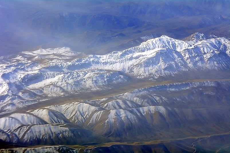
This week I decided to visit the Zagros Mountains. These mountains began formation nearly 541 million years ago and many rocks are deposited from the Mesozoic and Paleozoic era. The Zagros Mountains are located in Iran along the Eurasian and Arabian plates. These plates converged creating these mountains.The area is dominated by a folding structural style. The Zagros mountains are compressive in nature which can be determined due to anticline formations. Salt, and salt glaciers are deposited by this mountain range. It is also important for it's oil production.


Nag, O. S. (2017, April 25). Where Are The Zagros Mountains? Retrieved April 11, 2020, from https://www.worldatlas.com/articles/where-are-the-zagros-mountains.html 

Friday, April 10, 2020

C. Campbell_Week 5_Appalchian Mountains

Appalachian Mountains

This week, I once again find myself in familiar territory. My family has made the foothills of the Appalachian Mountains home for many generations of our family, now on both sides of my family tree. I grew up skiing the slopes of Seven Springs and Hidden Valley, never once stopping to think they had formed over 200 million years ago and used to reach heights that would make the Himalayas jealous! 


The Appalachians began their formation nearly 460 million years ago in a flurry of volcanic activity which scientists now believe could have thrown the earth into an ice age! They continued their formation in the time of Pangea when the North American continent and the African continent came crashing together in slow motion, vaulting ancient oceanic sediment, igneous and metamorphic rocks skyward. I happen to live in the Crystalline Appalachians, an area of the mountain range that is named for its Precambrian and Cambrian igneous and metamorphic rocks. 

Many folds can be observed in the mountains and a thrusting fault pattern is dominant. Coal has been and continues to be mined in the basin of the Appalachians and has stood up the oil and gas industry for generations of peoples. All of this aside, it is a beautiful back drop to many family photos and familiar place to call home. 


Week 5 - David Clark - Convergent Plate Boundaries - New Zealand


This Winter, I had a trip planned to New Zealand. Now with the coronavirus, I am not sure if that trip is still on. Suffice to say, it has been on my mind lately! So this week I wanted to visit New Zealand academically to see what kind of plate activity is going on there. I know that they experience a very high volume of earthquakes, and recently had a volcanic eruption. What is going on to drive these geological processes?! It turns out, quite a bit geological activity is happening in New Zealand.

First off, New Zealand straddles two plates, the Australian and the Pacific. But what I found so interesting is that one plate isn't submerging below the other along this line. What is happening under the North Island of New Zealand is the Pacific Plate is being subducted under the Australian plate in a normal fault. Then, about 1,000 miles to the South, under the South Island, the Australian plate is being subducted under the Pacific plate in a reverse fault zone! Oh don't worry, there is more geological activity going on. Between theses subduction zones, the plates are sliding past each other in a strike-slip fault, which is really a transform fault because it is "accommodating motion between two tectonic plates" (Lutgens & Tarbuck, 2016). Below is a good diagram of what is happening:

Obviously this massive amount of plate activity is the cause for the earthquakes in New Zealand. Whether along the subduction zones or the Alpine fault (transform fault), there is plenty of plate compressional activity happening. But wait, that's not all! Also along the North subduction zone, where the Pacific is subducting under the Australian plate, the Australian plate is under tensional stress, and it is thinning. This thinning of the plate, in combination with the subduction, is letting water and magma join together and rise, creating volcanic activity. In fact, New Zealand is a volcanic hot zone!

About 26 million years ago, volcanoes started erupted in and around New Zealand, creating new land as the volcanoes erupted. In geologically terms, this is pretty recent. For the last 26 million years, the volcanoes kept erupting, further expanding the New Zealand land mass. Obviously, this means New Zealand is composed of tons of volcanic minerals, but also contains oceanic minerals as well! Why's that? Well, apparently New Zealand may actually be part of a continent called Zealandia that is mostly submerged (geosociety.org):


Whether or not it ends up being categorized as a continental plate or not, this "continent-like" land mass exudes all the characteristics of a continental plate, except most of it's area is submerged. This brings me to my final point, that historically, New Zealand is exhibiting an oceanic to oceanic plate boundary convergence. I know for the assignment we were supposed to be focused on continent plate boundaries, but once I started researching this I couldn't stop! Also, depending on your thoughts from the article published on geosociety.org, this may actually be a continent plate boundary!


References:

Lutgens, F. K., & Tarbuck, E. J. (2016). Essentials of geology (13th ed.). Upper Saddle River, NJ: Prentice Hall.
 
https://www.geosociety.org/gsatoday/archive/27/3/article/GSATG321A.1.htm


Week 5 Travel Journal-Convergent Plate Boundaries


This week I decided to travel to the Himalayan Mountains. This huge mountain range began forming around 40-50 million years ago when India and Eurasia landmasses collided because of plate movement. 
Both landmasses have equal rock density and when the two collided, instead of descending along with the plate, India's relatively light sedimentary and metamorphic rock pushed against Eurasia plate. The intense pressure could only be relieved pushing upward and contorting the collision zone (which created the very jagged peaks of the Himalayan). There are brittle deformation microstructures within fractured rocks, fault gouge, and non-plunging folds found in the hanging wall. This information tells me that the deformation processes happened in the fault zone close to the surface. The Himalayans are compressive. The kinds of rocks being deposited are sedimentary rocks that at one point laid on the ocean floor. The types of rocks include marl, dolomite, greywacke, siltstone, shale, and limestone. You can also find igneous and metamorphic rocks such as quartzite, metamorphosed sandstone, shale and limestone, slate, marble, granite, diorite, gabbro, tonalite, monazite, pegmatite. Folding dominates the structural style and the fault is a reverse fault. 

Coronavirus: Himalayas visible as air pollution decreases across India

Week 5 - Samuel O'Connell (The Andes)

This week I chose to visit the oceanic/continental crust convergent boundary of Nazca plate and the South American plate, also know as the Andes Mountains. This subduction zone of mountain belts is relatively young, less than 100 million years old.  These mountains are actually the longest continental mountain range in the world, and spread through seven different South American countries, with a range over over 5500 miles. There are also several high plateaus with major cities established. Plateaus usually form from magma  pushing towards the crust but not breaking through, which leaves the flat, large areas of rock raised upwards. 

As the region is so large and is the result of both faulting and folding from compression, I chose to narrow my travels to Mount Aconcagua, the tallest mountain in the western hemisphere. The fellow travelers tell me that Aconcagua was once an active stratovolcano, before the angle of subduction f the Nazca plate began to decrease, which resulted in horizontal stresses that have created the thrust faults we can observe today. Along with this pattern of thrust faults has been observed a tendency of folding as well, and is referred to as 
the Aconcagua thrust and fold belt. These thrust and fold belts are caused from the newer front of the belt thrusting, while the older, inactive belts fold. 

The main rock deposit present at Aconcagua was actually first noted by Charles Darwin in 1835. He observed mainly rocked that have been determined to be volcanic andesite. Also present are sedimentary rocks  that have been dated to 300 million years ago. Sedimentary mesozoic rocks have deformed and are thought to have caused the folds located in the region. 

Climbing Mount Aconcagua, Argentina 2020/21 | Adventure Alternative


https://www.aconcaguatreks.co.uk/geography-altitude.html
https://www.researchgate.net/figure/a-Geological-map-of-the-Aconcagua-fold-and-thrust-belt-in-the-Yeso-and-Palomares-river_fig4_286202749


Thursday, April 9, 2020

Week 5 Himalayas Mike Bruno

This week I decided to travel to the Himalayas. The Himalayas are a mountainous region that was created millions of years ago when the Indian landmass collided with Eurasia. This collision was a continent to continent collision. While the two continents were approaching one another the oceanic crust between them was being pushed downward to make room. While this collision took place millions of years ago, today the Himalayas serve as a natural barrier between China and India. the point of stress in this region would have been where the Indian-Australian plate was moving downwards into the ground while the Eurasian plate was pushing into it. This spot is where the mountain range has risen. This spot is also where the Indian and Eurasian minerals will be deposited. The stress involved in this process was characterized as compression because the two landmasses were pushing into one another. Compression stress is known for forming two geologic features. The first feature at shallower depths is reverse or thrust faulting. The second feature is folding and this takes place at deeper depths. This land masses thrust faulting is what caused the Himalayas mountain range.


Week 5 St Lucia-Michael Nyadimo


This week i visit St Lucia in the Caribbean to look at it's convergent plate margin. It is said that the island formed through this type of boundary to become what it is today. This would mean that it is the continental crust and the continental crust that end up colliding. The rocks here seem to have compressive stresses as they are vertically thinning out. This is why they seem like they have a folded shape. Folding would be dominate as it is an island that was formed from continental crust pushing upwards. The type of fold can be considered an anticline because it is an up fold. The faults would be reverse because normally reverse faults are associated with compression which is what i have found here.