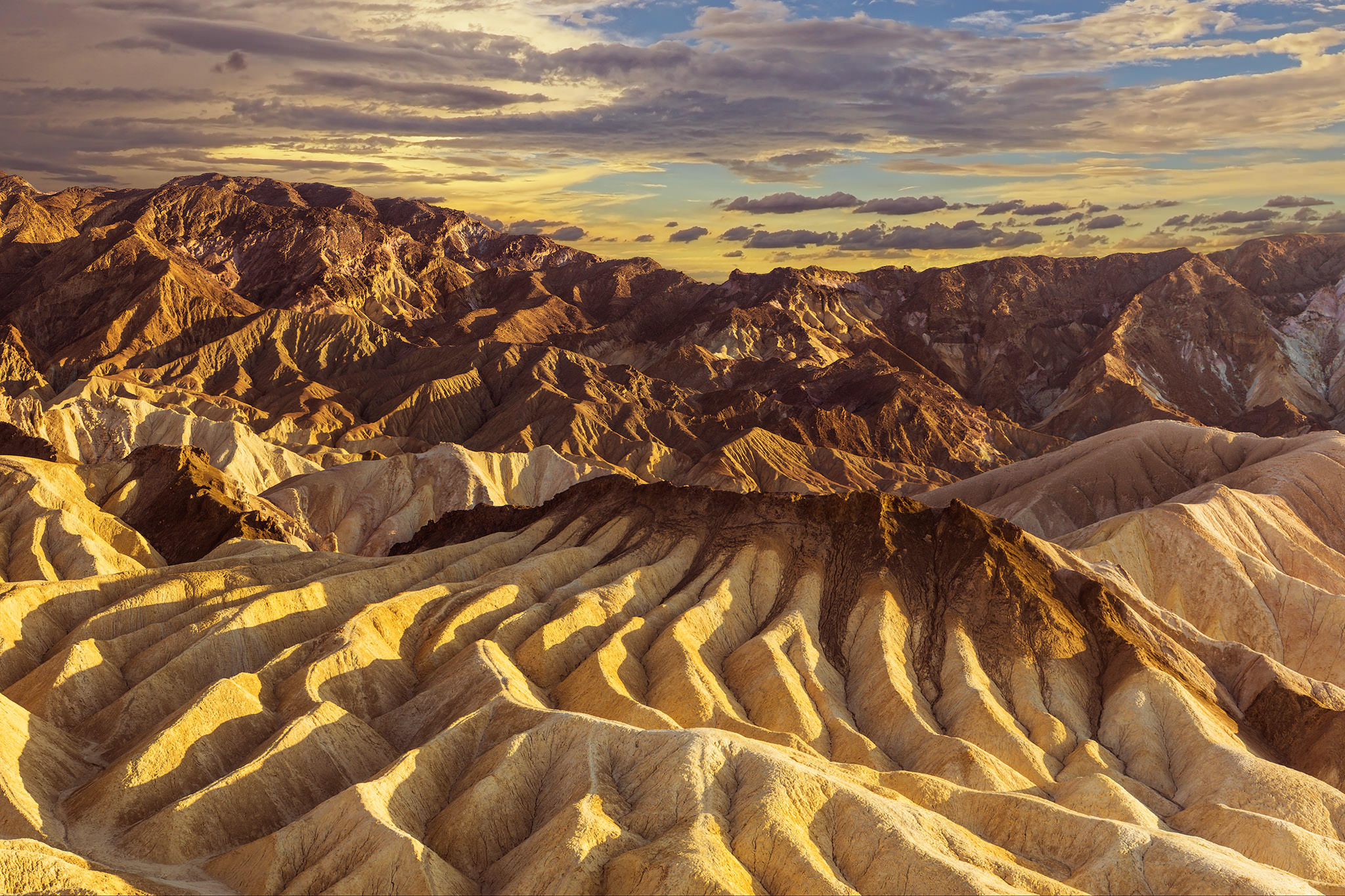
I
visited Zabriskie Point this week to observe one of the most famous landscapes
in Death Valley. Photos of this stop reveal unique lines and different colors
of rocks throughout the area. There doesn’t appear to be any uniformity one
would expect of layers being eroded slowly over time or being pushed up from
folding. I would like to know how this area was formed. I would also like to
know what causes the different colors. The rocks from each layer and the area
covered by Zabriskie Point would be useful in creating a geological map of the
area. From what I could learn, this area is part of the Furnace Creek formation.
The area used to be the base of a large lake nine million years ago. Ashfalls from
Black Mountain, saline muds, and gravel from nearby mountains were deposited at
the base of this lake. The area became more arid and the lake dried up,
revealing the formation. Widening and shrinking of Death Valley along with
uplift of the Black Mountains created the ripple effect in the tan sandstone
and clay. The dark layer was deposited as lava from volcanic eruptions from
three to five million years ago. I wonder where the shoreline of this ancient
lake was and a geological map could reveal this shoreline.
No comments:
Post a Comment