At the Badwater Basin, or Badwater Salt Flats, there are
exposed salts created by evaporation of Death Valley drainage. Looking at the image below and from research, I wondered how this area sits below sea level and what changes in geology caused the depression in the valley. Looking at the surrounding geology on a map may help to better understand the geology that left the flatlands. Digging below the mineral deposits may also help identify the rock formations that may have contributed to the basin and understand the age of the rocks. I also wonder if the flats were formed at a different time and shifted below sea level by fault movement. Maybe they are the result of erosion before the mountains around the area were formed, sinking and cutting off the basin from its ability to drain.
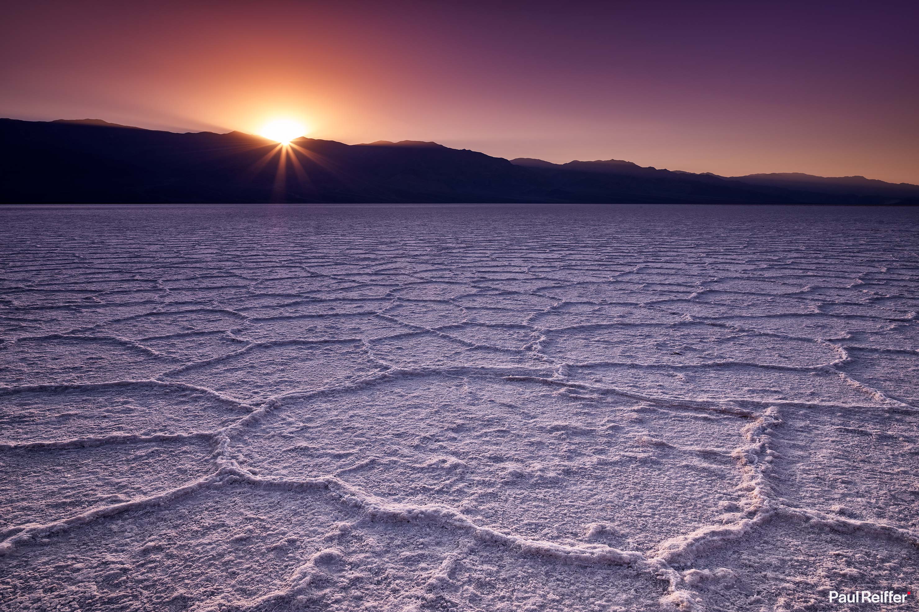 |
| Badwater Basin |
References
Salt Flats - Death Valley National Park (U.S. National Park Service). (n.d.). Retrieved December 14, 2019, from https://www.nps.gov/deva/learn/nature/salt-flats.htm
Reiffer, P. (2019, May 5). Death Valley; Photographs from the Hottest Place on Earth. Retrieved December 14, 2019, from https://www.paulreiffer.com/2019/04/death-valley-photographs-from-the-hottest-place-on-earth/
No comments:
Post a Comment