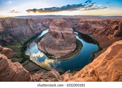
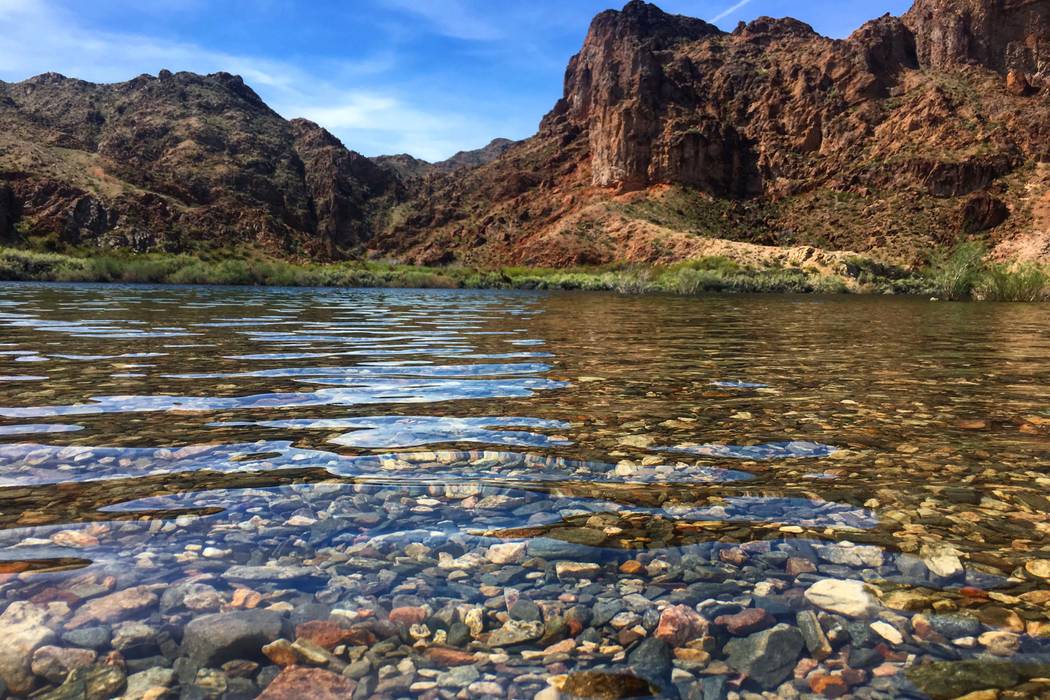
The Might Colorado River is a lesson in everything about a river, including what can go wrong when it is exploited. The first time I visited the many points on the Colorado was camping as a Boy Scout in my youth; the first picture below describes my primary image, in a photo I found online. The Colorado River is a mighty river that runs over 1,450 mies. The river is refreshed ephemeral annual snow fall in the Rocky Mountains. The river has a great history and runs from the mountains of Colorado to the Sea of Cortez in the Gulf of California. The factors that shape this river are the might Rocky Mountains and the incredible Grand Canyon. The first time I visited the Grand Canyon we took a donkey ride down the canyon to the river at Horseshoe Bend, in Arizona. The second photo below is a stock photo to recall that location. I remember the ride took about 90 minutes each way... I saw the water and wanted to go back up again! The river meanders in several places on it's long journey. This is a place to reach equilibrium in the flow of the water and energy and the best place to see that meander is the Grand Canyon. The velocity of the river drives it the 1,400 miles taking approximately 53 days from start to finish, and mostly does not finish. The velocity runs such as different course in different parts of the river journey we can find abrasion and dissolution in the sediment moving rocks, including suspension of the silt and dissolved loads of chemicals from the rocks themselves. This is known because and the estuary before the entrance to the Sea, the area has enormous enriched soil and deposits from the journey of the Colorado river. There is the waters in Colorado cutting through Granite rocks, to the grand canyon and finally the boulders and larger sediments in the river in my third photo below. Over a few times in the last 30 years has the water actually reached the Sea. Everyone knows the Hoover Dam and what that does tot to the river and disruption of the flow and the sediments. Most of the rock layers found at Grand Canyon are sedimentary, laid down over long periods of time by rivers flow from up-stream. A small amount of the sedimentary rock was deposited by desert winds. Many people do not recall The Glen Canyon Dam which was completed in 1963 blocked the flow for many years. This is my final stock photo below. I visited several years ago with friends as we went for a weekend on a boat in Lake Powell. for example 1998 marked the last time water reached the sea until 2014 when a pulse experiment was run to provide water all the way to the sea. The Glen Canyon Dam created Lake Powell. Hoover Dam was completed over 30 years earlier in 1936 and created Lake Mead. The Colorado river continues to be exploited. The Lower Colorado River, which provides water to seven states in including the cities of Las Vegas, Los Angeles, San Diego, Phoenix, and Tucson, and two Mexican states. The Colorado River already faces a major water deficit and is in danger of running dry far before the final part of the river. This risk is elevated further by shifting climate models as part of global warming. The highest velocity part of the river is often described in Grand Canyon National Park where pools in the river reach nearly 110 feet deep. Floods have happened with the Colorado River. Tthe lower Colorado River basin is one of the most flash-flood prone areas in North America. Texas and Colorado formed a flood plain coalition to plan for a prevent flooding in the region. In the Black Canyon, the Colorado wides and goes deep averaging 500 to 1,000 feet and approximately 1/4 of a mile wide. The texture of the river is highly varied, especially as the river has over 8 major tributaries contributing flow to the river, and making the flow into the Dams and the overall Colorado lasting all year long on a perennial basis.
The might Colorado is harnessed to serve mankind in fresh water in much the way the might Mississippi is harness for transportation and agriculture.
The Colorado River in Colorado - My Premier image of Camping by the River in Boy Scouts
RiverColoradoFotoeye75Dreamstime
The famous Horseshoe bend of Colorado River in Page, Arizona. - Where I took a Donkey Ride down to the water and you can clearly see sedimentary rocks . From Shutterstock
The Colorado River near Willow Beach, Arizona. (Janna Karel/Las Vegas Review - Example of larger sediment in the River
Las Vegas Review Journal
Glen Canyon Dam from GLEN-glen_canyon_dam.png and Lake Powell where I spent the weekend on a boat one time with friends.
References:
Colorado River, Beating Heart of the American Southwest, American Rivers, retrieved from:


No comments:
Post a Comment