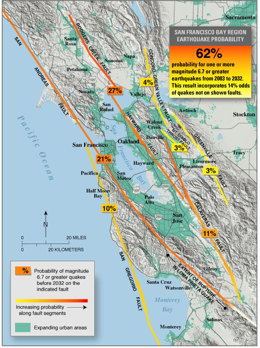
This week I decided to travel to Santa Barbara, CA and look at the cliff side homes. I am honestly amazed that majority of these houses are still standing and have not fallen into Monterey Bay yet. I would like to look at the cliffs and see what they are made of and what has kept them from being part of the landslides for so long. I'd also like to see the erosion to the cliffside that the waves are making. Landslide and watershed maps will both be very helpful with these. Finally I would like to investigate on how this area is affected by the fault lines that boarder it. The San Andreas Fault to the east and the San Gregorio fault to the west.
https://www.mercurynews.com/wp-content/uploads/2018/07/California_will_face_a_terrible_choice_Save_cliff-side_homes_or_public_beaches_from_rising_seas1.jpg?w=767
https://i1.wp.com/www.mercurynews.com/wp-content/uploads/2018/07/erosion1.jpg?w=810&crop=0%2C0px%2C100%2C9999px&ssl=1
https://upload.wikimedia.org/wikipedia/commons/9/9b/Eq-prob.jpg


No comments:
Post a Comment