These magnificent flats would surely posses no way to drain out if below sea level, and the cracked surface of the flats is further proof that evaporation is part of the process in creating this wondrous basin. However, that's just part one of my observation! The second part regarding elevation includes the altitudes of the mountains in the background of the photo, or the Black Mountains. If we know that there is no way for the basin to drain out, and there is little precipitation in this area year-round, where is the salt coming from to build up? Precipitation falling on mountains such as these, and other distant hills, creates floods; along the way down, salt minerals dissolve from rocks in the flood waters. Finally, the floods reach the basin where the water evaporates until only the sodium chloride remains, however, there are other minerals (calcite, gypsum, and borax) present in the various layers of salt. Since the basin doesn't drain at all, detecting what other minerals remain is vital to understanding the geological make-up of the mountain and hills surrounding the area. It's a sure-fire method to creating geological maps of Death Valley for future scholars to utilize in their studies!
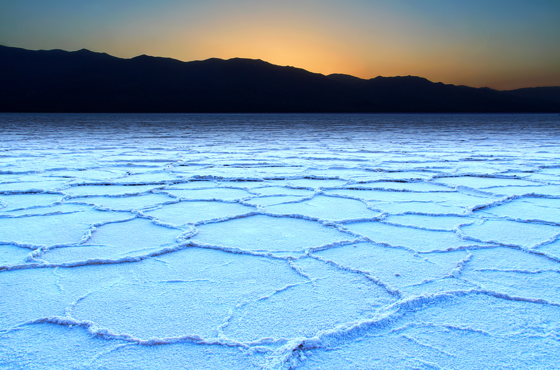
Crust layer of sodium chloride formed in the basin of the Badwater Salt Flats, located in Death Valley.
Source: https://elevation.maplogs.com/poi/badwater_ca_usa.98798.html
No comments:
Post a Comment