Sunday, November 29, 2020

Week 6: Geological Interpretations - Brandon Thammasine

 I have visited an area between Mammoth Lakes and Long Valley near the eastern edge of California. Upon browsing the California Department of Conservation website, I found a fault activity map of California. After looking at the map, it made me realize that there are numerous faults on the earth's surface. I don't think much about faults but there are a lot more than what I have imagined. 

My screenshot of the current faults that exist between the Mammoth Lakes (left side) and Long Valley (right side). "Fault Activity Map of California," CA.org, State of California, 2020, Fault Activity Map of California

What really stuck out to me was that there was a round fault in this area. Nearly all of the other faults were parallel to each other which may have been caused by the pacific oceanic plate pushing eastward into the U.S continental plate. That is why a lot of plates are similarly parallel to one another. But I am really curious as to why and how this circular fault occurred. 


Week 6- Geological Exposures - William Moran

Joshua Tree National Parks landscape is indescribable and can't be compared to any of the other national parks in the state of California. The San Andreas Fault bounds the South Side of the Park while the Pinto Mountain Fault covers the Northside and smack dab in the middle of the park is the Blue Cut Fault. The use of a seismographic would help determine which of the faults is most active along with the severity of each earthquake in the surrounding area. The website also has maps of mines and mineral resources throughout California which would be helpful while looking at the map of Joshua tree as it was once an area that was mined. You are still able to walk up to the mines and see some of the old rail lines but the mines themselves have had steel bars put in place to block off hikers from going in as they are dangerous and unstable due to how old they are and the fact that three major fault lines cross throughout the park. 

Week 6 - Geological Interpretations - Cory Hall

     When thinking of anything related to geology and natural occurrences of geological processes The San Andreas Fault Line immediately pops to mind. The first piece of information that I would find helpful would be a map of the fault line and the movement of the colliding plates. I feel like this is the most important piece of information related to the fault line and everything that happens in the vicinity. Another tool that would be helpful in studying the area would be a seismograph. I think that  if you're able to tell when tectonic activity is taking place, it would be easier to observe the other surrounding side effects. The final piece of information I would like would be regional CO2 emission reports. I know the ideas surrounding global warming are relatively new, but I think it would be neat to see if there's any correlation between the oceans heating up and activity within the fault itself.


© David Lynch


Journal #6 Geological interpretation, Ricardo Aguilar


Journal week #6


In my case I decided to make questions regarding two different geological areas and geological resources and the California Department of conservation itself. This regarding its role in activities that impact this states geological landscape transformation. Thus, aspects I believe are directly related to geological alterations in such a seismologic zone as the San Francisco area and the many valleys surrounding this state. for example, in terms of states oil and gas wells, in terms of oil and gas excavations, I found that the department of conservation is very strict in terms of permitting the drilling, gas and oil extraction due to the geological zone that he valley of San Fernando and San Francisco represents for the population living in that area. I was also curios over the mines and mineral extraction or mining in zones near some seismologic areas, I found that for this matter the department of conservation subjects to strict geological investigation for assessing and determining the zones for mineral and mineral mining which is very important for the geological zones in terms  of  environmental impact. They are concerned that some geological alterations in this zone might signify geological land alteration. lastly, I fond very interesting for the land use and planning the department of conservation intervenes in every geological zone of this State of California my question regarding this department would be how do this department informs to the public how to locate the wells and mining sites. This a publication issue with in this institution.


 The California Department of Conservation, Geologic Energy Managment Division publishes a GIS feature class of well locations and its associated records across the state for use by the public.

Geological Interpretations - Tyler Osterberg

 For this week's blog post I am visiting McArthur-Burney Falls Memorial State Park.


My geological interpretations would be requested for fault activity, landslide inventory, and the corresponding geological map.  The first and second would give active geological changes in the area I have chosen.  These would give us new cross-sections of strata that we can record.  Comparing these records with the geological map that we requested third would be used to make updates to the geological map.

Photograph screenshot from https://www.conservation.ca.gov/cgs/Documents/Publications/Special-Reports/SR_230-GeoGems-Notes-LR/CGS_SR230_McArthurBurneyFalls_MemorialSP_lr.pdf

Week 6 - Geological Interpretations - Travis Suggitt

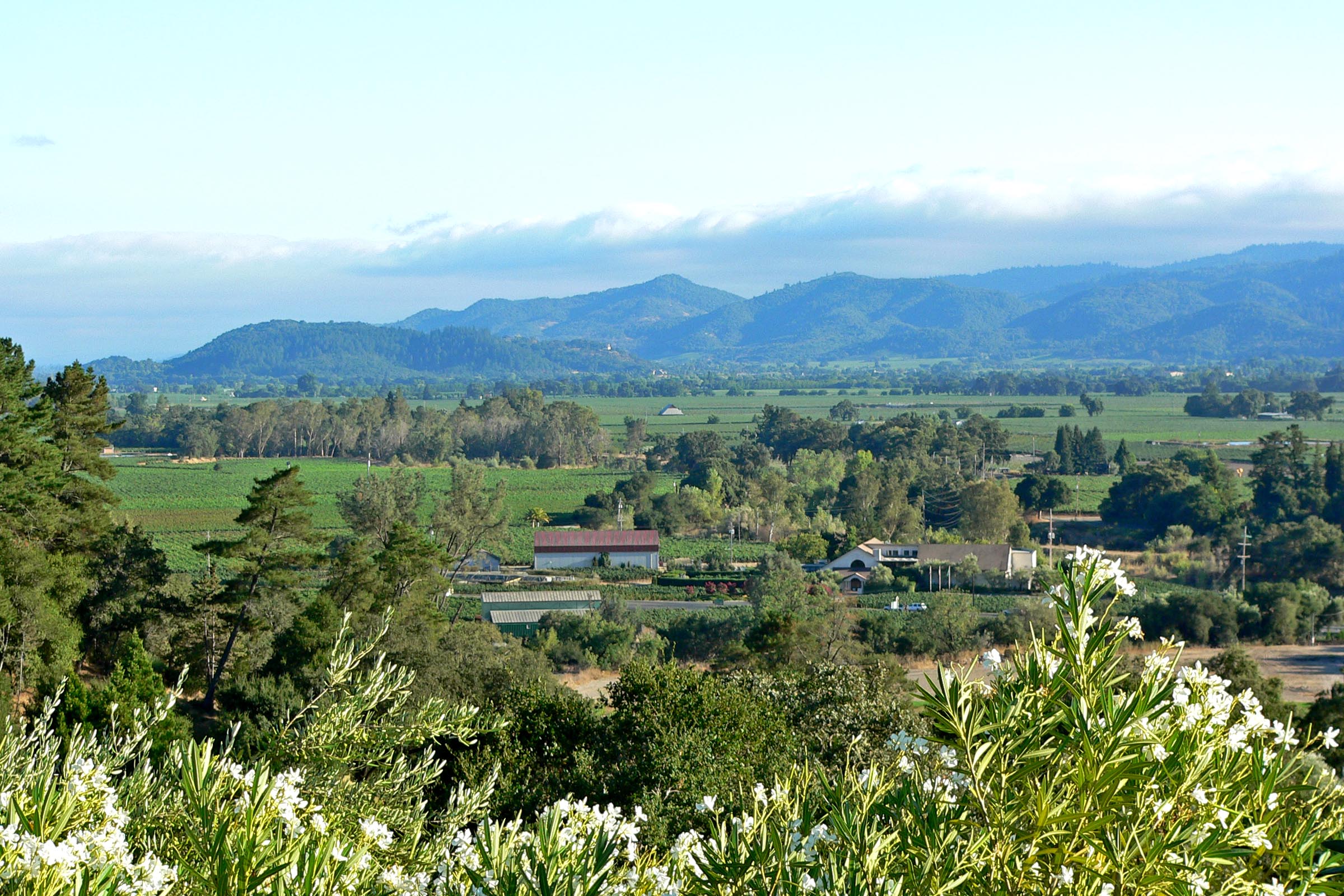
In the region area that splits Sonoma Valley to the west from Napa Valley to the east, minerals from a wide range of periods are found. The mountains are mostly volcanic rocks from the tertiary period with older Quaternary alluvium found in the lower elevations such as the valley floors and younger Cretaceous period minerals on the western edge of Napa Valley. Radiometric dating from various places would likely confirm the geological map.

Sonoma Mountains viewed from across Napa valley (Shebs, 2005)

In areas where the Sonoma mountains meet valley floors on either side, the Geological map shows several distinct groups of Quaternary alluvium that are dated younger than the Quaternary alluvium of the valley floors. Using information on the location of mountain creeks, one could determine if these are alluvial fans which formed which carried sediment to the floor from higher elevations.

In the furthest south portion of this area (just north of the bay), a blob of Quaternary volcanic rock is seen. Comparing the blob to a topological map indicates that this is a high point named Sears Point. Since the rocks that surround it are of a younger volcanic origin and considering the principle of superposition, we could determine that there is more Quaternary rock from this formation covered by the later volcanic rocks.

Photo reference:

Shebs, S. (2005, September). File:Napa Valley from Auberge du Soleil 1.jpg in Wikimedia Commons. https://commons.wikimedia.org/wiki/File:Napa_Valley_from_Auberge_du_Soleil_1.jpg

Week 6 Geological Interpretations-Hirra Faizi

 While searching through the California Department of Conversation's website, I came across the link for tsunamis. In brief, a tsunami is a series of waves which results from the occurrence of an earthquake, landslide, volcanic eruption, or a large meteor hitting the ocean. In terms of an earthquake, when they occur they cause a large movement of the sea floor which goes upward and results in the rise of water. Tsunamis can travel around 500 mph across the open ocean but slow down to about 30 mph as it approaches land. For an area prone to tsunamis, there are warning signs to help prepare for it. One of the most noticeable signs is the rapid receding of ocean water before the first wave of the tsunami hits. It's also important to note that not all earthquakes have resulted in a tsunami but in prone areas it is wise to be on the lookout so you can safely evacuate. In addition, there has been a tsunami preparedness brochure for boaters. This is because tsunamis in the state had caused about $100 million in damage to the maritime community. Furthermore, the California Geological Survey (CGS) provides us with geologic and seismic expertise to the public and works with the government to make statewide tsunami inundation maps and preparedness for the state. This website provides the state of California's residents with more than enough information regarding the history of the complex geology there as well as essential information on how to prepare for natural disasters. 

                                                                    California Tsunami


                                                                californiaeqclearinghouse.org

Week 6 Geological Exposures - Joshua Rosson


                                                    (Photo credit: Bob Wick)

I chose the Mojave Desert as my region. The first piece of data that I would request is the map of fault lines that the Department of Conservation provides. The reason this is so important is due to the explanation that it can provide for the various volcanic eruptions that have occurred in during the formation of the Mojave. Across the desert there are several cinder cones pointing towards the Mojave being located near several faults. Next I would request the historical data of the water table. This is due to the soda lakes showing evidence of water quickly evaporating in an arid climate with no way to the sea, leading me to believe that the coast of California was once more inland than it is now. Finally I would ask for a topographical map. This combined with the fault line data can show evidence of plates that are colliding and being raised which would explain the Mojave's formation into a arid desert.

Sources:

Logan, M. (2019, July 30). How We Defeated a Corporate Scheme to Sell the Mojave Desert's Water. Retrieved November 29, 2020, from https://earthjustice.org/blog/2018-november/we-re-fighting-a-corporate-scheme-to-sell-the-mojave-desert-s-water

Week 6- El Capitan

 El Capitan, Yosemite National Park, United States

The image above displays El Capitan, located in Yosemite National Park. El Capitan is the largest monolith of granite in the world. The collision of tectonic plates caused its formation some 220 million years ago. There are a number of different types of granite rocks on the face of El Cap, however they were all formed from the heating of the magna under the surface from the collision of the plates. Glaciers then carved through and created the valley floor 3 million years ago, putting the final touches on the mountain. This is an absolutely astonishing geological formation and attracts many experienced rock climbers every year. 

Week 6 - Santa Monica Mountains


The Santa Monica Mountains stretch northwest of Santa Monica and Los Angeles down the coasts of California, east to west. With a broad number of minerals, including marine and non-marine sedimentary rocks and volcanic ash, the mountains are diverse in their geology. In addition, there are a huge number of folds and a collection of fossils in the field. The mountains are now starting to shift sitting near active faults. The mountains are not as old as others. Most of the rocks are from the Tertiary and Quaternary period, with most less than 20 million years old which is pretty young.


References

[Digital image]. (n.d.). Retrieved from https://www.nps.gov/im/images/5CA33EC9-9570-0AFF-CCC23752592132B7HiResProxy.jpg?maxwidth=650&autorotate=false


Saturday, November 28, 2020

Week 6 - Geological Interpretations - James Cebry


In researching the California Department of Conservation website, I found a page on Landslide.  When I lived in California this was something that had affected me, so I found it interesting.  I found that there are several different categories of landslides that include: earth flows, debris flows, debris slides, rockslides, and rock falls.  The different categories depend on if it is only soil or rock or a combination of the two.  An earth flow is a specific type of flow where the majority of the soil material is fine-grain silt and clay.  A debris flow is where the soil is a majority coarse-grained material from sand to boulder size particles.  A debris slide is similar to a debris flow but is generally on a steeper slope and carry more power.  A rockslide is a landslide that involves bedrock that move and remain largely intact.  A rock fall is where a massive rock detaches from a steep slope and descends mainly through the air.

Landslide can be a big problem in many areas of California because it causes damage to houses, roads, and other structures.  Landslides become a big problem when the rain season comes.  Most of the year California is very dry and does not receive much rain fall.  This makes many areas have dry and brittle vegetation.  With the combination of Santa Ann winds in the south or Diablo winds in the north that bring hot dry air from the desert into the coastal regains.  This creates very good conditions for wildfires which burn all of the vegetation from the mountain sides.  Once most of the vegetation is burnt away there is nothing to hold the soil on the mountain sides.  The next time there is heavy rain it creates landslides.

Map of Resent Landslides


Friday, November 27, 2020

Week 6- Geological Interpretations-Bridget B. Mensah

While searching through conservation.ca.gov a picture of the King City Asbestos Corporation Mine (KCAC mine) back in 1998 caught my eye. I was going through the hazards tabs when I came across a map of California that detailed hazardous minerals.

The mine opened back in 1992 but closed in 2002, it was the last chrysotile asbestos operating mine when they shut down. Scientist began to realize that "asbestos was a major cause of various diseases including lung cancer, mesothelioma and a scarring of the lungs that was given the name “asbestosis”. Use of asbestos declined rapidly, with many countries banning the substance, and extensive efforts made to remove asbestos from buildings." (Bustmold.com) With those dangers in mind, it was then estimated that about 40-50% of the mine was made out of chrysotile asbestos, so you can imagine how dangerous working in mines like KCAC was. In 1906 the very first death of an asbestos worker was recorded, he died from pulmonary failure. The autopsy found showed a large number of asbestos fibers in his lungs. 

While going through conservation.ca.gov I realized just how many geological complexities there truly are. I also learned that the San Andres fault isn't California's only problem. 


This is the 1998 picture that I was referring to. (Photo Credit: conservation.ca.gov)


Week 6- Geological Interpretations-Tim Pester

 While searching threw the California Department of Conservations website, I came across the link for Geologic Hazards. I found this link to be interesting because it helped to summarize the last four weeks of learning in this class. From seismic hazards like earthquakes to other hazards like landslides or minerals like radon and mercury to volcanic hazards that being monitored by experts. In the section of earthquake, it went into more detail about how tectonic plates moving against each other keep the lands of California unstable. While scientists are using programs like The California Strong Motion Instrumentation Program (CSMIP) to record the energy being created by these plates as well during earthquakes to help assist in emergency planning and action (California, 2019).

 The next link I saw on the website is Tsunami Preparedness. I don’t know why, but always had an interest in how tidal waves were created. From the article, I learned that California has active offshore faults and unstable submarine slopes that can increase tsunami activity near the coast. While, I understood that earthquakes cause tidal waves, with the energy they create, I was unaware that other factors like slopes increase the likelihood of a giant wave (California, Tsunami Preparedness, 2019).


A map of the San Andreas Fault line and Pacific Plate. And how the North America Plate and Pacific Plate are brushing up against one another to create the uneasiness in the region.


Works Cited

California, S. o. (2019). Geologic Hazards. Retrieved from California Department of Conservation: https://www.conservation.ca.gov/cgs/geohazards

California, S. o. (2019). Tsunami Preparedness. Retrieved from California Department of Conservation: https://www.conservation.ca.gov/cgs/tsunami/preparedness

Week 6 Geological Interpretations -- Robbie Todd II

 When searching around I found the fault evaluation for Mount Baldy to be very useful.  I used to live in the area and I found it exciting to find out what was going on under our feet.  It is amazing how much activity is happening in the area.  I was also able find an earthquake map for the area as well.  This is really neat as I only lived a few 100 yards from the San Andreas fault line.  I am surprised I didn't feel more movement and earthquakes while living there.  Even though I did not live next to the coast, the tsunami map was very useful.  I didn't realize how many people would be affected and live within a tsunami warning area.  These are the few maps I found useful during my study.  The reason for this is I still have friends that live in these areas and are affected if a natural disaster happens.


Robbie


Reference

California, S. O. (n.d.). Department of conservation map server. DOC Maps. Retrieved November 27, 2020, from https://maps.conservation.ca.gov

Thursday, November 26, 2020

Week 6- Volcano watch using Hawaiian eruptions to understand Volcansim

 When I went to visit the map site for California this stood out to me the most. There are currently 5 volcanos being observed from high to low threats currently in California. This information was released recently on November 12th 2020. So far the information that they have is not old enough to determine how or when the Volcanos will erupt. It has caused a dilemma for the geologist to know in the future when they will erupt; because the magmas from different regions erupt in different ways, it was stated that next eruptions can range from days, weeks, months, years or several decades. California,  has the classic-looking mountainous stratovolcano of Mount Shasta and the large caldera of Long Valley, but neither has erupted historically though each has evidence of geologically young activity. The most recent eruption in California was from 1914–1917 at Lassen Peak, creating a lava dome and related ash deposit, in what is now Lassen Volcanic National Park. An area east of Mount Shasta and Lassen Peak is relatively flat but contains ‘young-looking’ lava flows.

They also presented the statuses of the volcanos they are watching,  Kīlauea and Mauna Loa, Brushy Butte none of these have erupted as of yet. My questions for this experiment is 1. Why is this information important, what do they plan on doing with the information found. 2. Most of the volcanos havent erupted in nearly 20 years are they using anything special to expediate it? 3. When and if the volcanos do erupt how would that affect the plants and creatures around it?


 (https://www.usgs.gov/natural-hazards/volcano-hazards/about-alert-levels). Kīlauea updates are issued monthly.

Week Five- Fold Mountains

 This week I decided to take a virtual trip to the beautiful city of South Africa where the Cape Fold Mountains are present. I discovered during my journey that the Fold mountains are created when two or more Earth tectonic plates are pushed together, often known as convergent plate boundaries and continental collision. Not all fold mountains are soaring peaks. The Appalachians, stretching along North America’s east coast, are generally low-lying, gentle slopes. Millions of years ago, the Appalachians were taller than the Himalayas! Millions of years of erosion, however, have taken their toll. Today, some of the highest peaks of the Appalachians are less than a third of the height of Everest. 


The crust that is now the Appalachians began folding over 300 million years ago, when the North American and African continental plates collided. Plate tectonics created this ancient mountain range, then called the Central Pangean Mountains . . . and plate tectonics tore it apart. As tectonic activity ripped apart the ancient supercontinent Pangea, the African, Eurasian, and North American plates drifted apart.

https://www.nationalgeographic.org/encyclopedia/fold-mountain/

Wednesday, November 25, 2020

Week 5 Convergent Plates

 Oregon Coast - Wikipedia

This week I decided to stop at one of the most beautiful coastlines in the US that also happens to be a convergent plate boundary, the Washington Oregon coastline. This boundary is the convergence of oceanic  crust and continental crust. The convergence of the plates is a subduction zone, meaning the oceanic crust is being pushed under the continental crust. This is known as a thrust fault. Eventually the crust reaches extreme temperatures and creates magma under the surface, which is responsible for the numbers of volcanoes in this region. Igneous, Sedimentary, and metamorphic rocks are all found in abundance along this coastline. 

Sunday, November 22, 2020

Week 5 Convergent Plates Hirra Faizi

     I have decided to visit the Himalayan mountains for this week's journal because I was recently reading 

up about it. The Himalayan mountain range has formed from the result of a continental and continental 

collision between the Indian Plate and Eurasian Plate which took place about 50 million years ago. This 

range resulted from huge tectonic forces and sculpted by the process of weathering and erosion. The 

Himalayas was formed by compressive stress which we know squeezes rocks together causing them to 

fracture or fold. Additionally, this mountain is made up of metamorphic rocks and granites that are 

situated very high. As mentioned, this area was a collision zone where tectonic plates push up mountain 

ranges so we know it is a reverse fault where one block of crust slides on top of another. 


                                               Himalayas -wikipedia.org


Himalayas-eartheclipse.com


Week 5 Convergent Plates - Joshua Rosson - Ouachita Mountains


                                                (Photo of Ouachita Mountains sourced from NPS)

The Ouachita Mountains located on the eastern side of the North American within the Appalachian Mountains is a continental crust against a continental crust formation that exhibits large thrust faults with horizontal breaks. These compressional thrust faults create folding in the sedimentary rock. Layered waves of sedimentary rocks to include sandstone, shale, and chert show evidence of when Gondwanaland collided with the southern edge of ancient North America to form the Ouachita Mountains.

References:

Lutgens, F. K., Tarbuck, E. J., & Tasa, D. (2016). Essentials of geology. Hoboken, NJ: Pearson.

Lillie, R. J. (n.d.). Convergent Plate Boundaries-Collisional Mountain Ranges. Retrieved November 23, 2020, from https://www.nps.gov/subjects/geology/plate-tectonics-collisional-mountain-ranges.htm

week 5, travel journal the Himalayan Mountains

Week 5, travel journal, The Himalayan Mountains


The convergent- plate margin I decided to visit was the Himalayan Mountains, this mountain- building is the geological formation resulting of a continent crust against continent crust collision. This event could have been taken place close to 45 millions years ago when India began to collide against Asia.

             The subduction zone that initiated this continental motion to northern India was located near the southern edge of Asia. Continued subduction along the edge of Asia created an Andean type plate edge that contained a well- developed volcanic arc and an accretion prism. The northern Indian rim on the other hand was a passive the continental rim composed of a thick platform of shallow water sedimentary rocks.

Thus, the Eurasian plate was partly crumpled and buckled up above the Indian plate but due to their low density neither continental plate could be subducted. this caused the continental crust to thicken due to folding and faulting by compressional forces pushing up the Himalayan and the Tibetan plateau.

The tectonic forces involved in Indian collision with Asia were enormous and caused the most deformable materials located on the littoral edges of these continent to   experience large folds and faults. Reverse faults also called thrust faults, slide one block of crust on top of another. These faults are commonly found in collisions zones, where tectonic plates push up mountain ranges such as the Himalayan and the Rocky Mountains.

All these faults are related to the earths tectonic plates and the shortening and thickening of the crust lifted large amounts of crust material generating the spectacular Himalayan Mountains


Week 5 - Dustin


 The Andes mountain range lies along the coast of South America. The Nazca plate and the South American plate have met and the Nazca has been subducted. Due to the friction, it is not a smooth slide for the plates and has resulted in countless thrust faults. Parts of the South American plate are folded as well, this is what has produced the Andes mountaints. 

Saturday, November 21, 2020

Week 5- Convergent Plates- Tim Pester


A picture from the Rocky Mountains National Park, as the sun wanes on the horizon before disappearing behind another mountain.


For this week’s travel journal, I chose to stay close to home. I pretty much just looked out my window to the west, here in Colorado, and saw the great Rocky Mountains. These massive peaks, that stretch across the western horizon, are evidence of converging tectonic plates. While I am only seeing a fraction of the great mountain range, as the full range begins in northern Canada and follows an almost straight line south to New Mexico. The Rocky Mountains formed about 80 Million to 55 Million years ago when multiple tectonic plates began to slide underneath or collided with the North American plate. The forces from these two actions, created a thrust fault which had enough force over time to lifted the bedrock high into the sky creating the mountain range. Glacier erosion has also helped to carve the mountains to their present beauty, as the ice cut through the rock and created the valleys and mountain lakes. While like most of the regions in the Southwest part of North America, the Rocky Mountains contain Paleozoic sandstone, limestone and also interbedded with volcanic granites. While most of the folds are created by the thrust fault, the appearance of syncline folds can be viewed in the rock formation of the mountains. 

Works Cited

The Formation of the Rocky Mountains. (2005). Retrieved from MountainNature.com: http://www.mountainnature.com/geology/platetectonics.htm

Friday, November 20, 2020

Week 5 - Converging Plates - Cory Hall

     The area I have always wanted to visit is the Cascade Mountain Range located in north western United States and south western Canada. This range travels through Oregon, Washington, and California in the U.S. and through British Columbia in Canada. The Cascades were formed from the Juan de Fuca Oceanic Plate converging with the North American Plate. The results of the two plates colliding caused thousands of smaller, short lived volcanoes to form and, relatively quickly, die out. This is because as the smaller and less dense oceanic plate pushed against the North American Plate, the oceanic plate subducted under the continental plate causing mass amounts of pressure to build up to form said volcanoes. This area is also located along the Ring of Fire, a horseshoe shape of oceanic trenches, volcanic arcs, and volcanic belts. The Cascades contain a reverse fault, causing the two plates to converge on each other, forcing the rocks to fold onto each other forming the path that would make way for volcanic activity.


                            Photo by Mary Anglin 4/3/2007

Week 5 - Converging Plates - James Cebry

One place that I went to when I was stationed in Italy was the central Alps. My wife an I took a train from Munich, Germany through the Alps to get to Salzburg Austria. The mountain out there are very steep and have a jagged look to them. They are very tall almost looking like fingers trying to catch clouds.
This is a picture from Eagles Nest which was one of Hitler's Bases he used. Has you can see it is high up in the Austrian / German Alps and the mountains look they they are grapping for clouds.


 The Alps were formed from compressive forces on the European and Adriatic plates. When these plates compressed together it formed folds of Precambrian rocks and younger marine sedimentary rocks. Many of the mountain have folding structural styles but there are some faulting structural styles in the Austrian and Italian Alps. In the area where I traveled it has normal faults. While they have not been active in awhile the fault lines are still there.
This is another picture of the Italian Alps form the Italy tourist website showing how jagged the mountains can be.


Picture References: 
https://discoveritaly.alitalia.com/en/us/destinations/milan/stelvio-national-park-central-alps https://www.grayline.com/tours/salzburg/eagles-nest-salt-mines-bavarian-alps-11862_5_12130_940/

Wednesday, November 18, 2020

Week 5 - Converging Plates - Bridget B Mensah

 I recently decided to visit the Himalayas for a quick trip to get my mind off school. It was a beautiful and historic sight to see. It’s crazy to think that such a large mountain is the youngest mountain range on the planet. The first thing I noticed apart from its height was the jagged but steep peaks.

A beautiful phot captured by another tourist that was on the same trip as I was
(Photo Credit: Thelandofsnow.com)

They are compressive and you can find deposits of sedimentary, metamorphic, and even igneous rocks around the Himalayas. Folding definitely dominates the structural style of the mountains. There may be a few faults here and there that are normal but in total and in general, folding is what can be seen the most when looking at the Himalayas. Plus knowing that the Himalayas formed due to a collision between the Indian Plate and the Eurasian Plate helps. Fun fact the collision is still going on even though it started over 50 million years ago. Even though the Himalayas are still rising to this day they are still eroding. I have visited many places and historical sights around the world but visiting the Himalayas was definitely one for the books.


Week 5 - Converging Plates - Travis Suggitt

Dent de Morcles: A fantastic fold in the Swiss Alps

For our most recent biennial trip to visit our European friends, a group of travel companions and I chose to tour around the alps, taking in the iconic range which formed by converging plates. Staying in Switzerland, it takes little effort to find evidence of the African plate meeting the Eurasian plate ages ago, and a day spent at Dent de Morcles presented us with a clear example of folding. Wanting to get a view of the mountain rather than summit it, we followed trails to the mountain’s south-western face where wavy lines in its strata are the dominating feature.

Curves are noticeable in the strata of Dent de Morcles, with the most prominent pictured here on the left near the summit (Summitpost, 2005).

Knowing that limestone is a product of ancient marine environments, it feels odd to say that the mostly limestone structure was lifted as the African continental crust rode over the Eurasian continental crust. However, this limestone was likely produced on a seabed once separating the continents. As the continents moved towards each other, closing the sea out of existence, tremendous pressure compressed the horizontally layered seabed causing overturned folds.

Folds like the ones seen on Dent de Morcles (foreground) exist on the distant mountains, likely once a connected formation that was separated by erosion (Edmaier).

The two plates continue to converge, creating more folds below us and raising the alps. In the impossible situation that our biennial trips continue for many millennia, we can return to see a noticeably taller Dent de Morcles.

Photo References:

Edmaier, B. (n.d.). Dent de Morcles, Switzerland. Bernhard Edmaier. https://www.bernhard-edmaier.de/en/images-of-the-earth/mountains/dent-de-morcles-switzerland/

Summitpost. (2005, August 15). Dent de Morcles (July 2005). Image ID 120420. https://www.summitpost.org/dent-de-morcles-from-the-way/86217/c-153049

Week 5 - Rocky Mountains

This week I decided to take a virtual trip to the Rocky Mountains, a spot where many people in Colorado like to hike, camp, and enjoy the regions wonderful beauty. Although the Rocky Mountains are starting in Canada, many have explored the area from Colorado to New Mexico.

 I discovered that the central parts of the mountain range are made up of a continental crust which is more than 1 billion years old. In the case of this mountain range, the rocks were still in place until the converging change of the plates lifted them to a series of mountains. The change that triggered it was dubbed the Laramide Orogeny.  The Laramide Orogeny is an geological event that happened over the course of 30 million years during the Cretaceous period. Since the initial growth of the mountain range, the ice solidified the present form by rolling over the rocks and eroding them to some degree. The effect is a spectacular collection of soaring mountains that make for wonderful hiking, with plenty of lakes and steep valleys.

 Retrieved from https://media.tacdn.com/media/attractions-splice-spp-674x446/07/88/4d/9a.jpg


Retrieved from https://images.mapsofworld.com/answers/2017/09/map-of-rocky-mountains-usa-canada.gif


Tuesday, November 17, 2020

Week 5 Converging Plates -- Robbie Todd II


While living out in California I lived a 15 minute ride from Mormon Rocks.  It got its name from Mormon settlers in 1851.  This is an amazing place and really fun to hike around.  Lots of different trails and climbing spots.  My dog Griffey and I would go explore almost every weekend.  Some of the small things I missed about living there.


So let me tell you about how the Mormon Rocks were created.  These rock features are at the southern end of the san Andreas Fault in California.  The San Andreas fault is the most important tectonic structure in California.  It is a right-lateral strike-slip fault that has some subsidiary faults at the boundary between the Pacific and North American Plate.


The Mormon Rocks is a great example of how tectonic forces can uplift and tilt strata.  Mormon Rocks are sandstone that has been pushed up by a sub-fault of the San Andreas fault.  While climbing around you can see the uplifting and folding that is happening in the area.  You can see the sandstone has been worn down by the winds and rains over time.  It is a great place to see the forces of plate tectonics and climbing around it very fun.

Robbie


Reference

Field trip 3: San andreas fault, mormon rocks, and devil's punchbowl: Earth science field trips in southern california. (n.d.). Field Trip 3: San Andreas Fault, Mormon Rocks, and Devil's Punchbowl. Retrieved November 17, 2020, from https://cerritos.instructure.com/courses/31759/pages/field-trip-3-san-andreas-fault-mormon-rocks-and-devils-punchbowl

Sunday, November 15, 2020

Week 4: Volcanoes Brandon Thammasine

     I visited the Kilauea volcano in Hawaii. Located in the southeastern part of Hawaii, Kilauea is the youngest volcano on the island. Not being the only volcano on the islands, Kilauea and many of Hawaii's volcanoes were formed in the middle of the Pacific Plate and rose from the ground through a hot spot. This is interesting because hot spots do not form from Earth's moving tectonic plates. Instead, heat from Earth's mantle moves up through the lithosphere and eventually makes it way up to the Earth's crust. Magma then reaches Earth's surface through cracks in the crust which form volcanoes like Kilauea and many others in Hawaii (National Geographic Society, 2012).


Stream of lava from Pu‘u ‘Ō‘ō flowing through the forest in the Royal Gardens subdivision, February 28, 2008. USGS.gov

     It is clearly evident that Kilauea has erupted before as it is an active volcano. Aside from it being active, there are visible basalt formations around the landscape of the volcano which form through the cooling of magma. Based on the basalt formations, it also can be inferred that the eruptions were slow-flowing. The formations help prove that streams of magma have flowed through the lands. 

    As mentioned earlier, Kilauea is an active volcano so the land surrounding it is a hazard to people as an eruption of hot magma is likely to happen. 


References


National Geographic Society. (2012, October 09). Hot Spot Volcanism. Retrieved from https://www.nationalgeographic.org/article/hot-spot-volcanism/#:~:text=A hot spot is a,the crust to form volcanoes.&text=Instead it occurs at abnormally hot centers known as mantle plumes.

Week 4 Volcanoes- Ryan

 Hiking Mount Vesuvius | ITALY Magazine

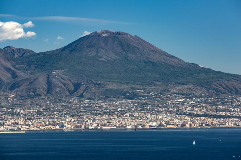
This week I decided to take a trip to Italy and visit the great Mt. Vesuvius. Vesuvius is located on the Campanian volcanic arc, a line of volcanoes formed over a subduction zone. The volcano is most famous for its eruption in 79 AD when it destroyed the cities of Pompeii and Herculaneum. Today, Mt. Vesuvius remains an active volcano and represents a great danger to surrounding cities even though the last eruption was in 1944. As of right now, Vesuvius only has minor seismic activity however violent activity could resume in the future. 

Week 4- Volcano - William Moran

Mount St. Helens


    Located in Washington state Mount St. Helens is considered a dacite volcano. A dacite volcano is light in color and made up of volcanic rock with heavy concentration of silica and potassium. The volcano is the most active in the Cascade range and was formed 275,000 years ago through four separate stages. The main portion also known as the edifice, of older St. Helens was formed sum 12,800 years prior. The newest edifice which is part of the lower crater was formed about 3,000 years ago. St. Helens had a steam eruption in 1980. Following the eruption came periods of quiescent followed by a small eruption. Mount St. Helens will most likely erupt again but it is hard to find out when and at what magnitude.


A journey to the Mexican Volcano “the Popocatepetl”


Ricardo Aguilar

A journey to the Mexican Volcano “the Popocatepetl”


The Popocatepetl is a Mexican volcano that in recent time registered a strong explosion, this is a volcano that has been active for at least 25 years in modern time. After a long period, quietness in which no major explosions were recorded. It was on 2999 B.C this according to a detailed record of the activity of the Popocatepetl of the general coordination of civil protection of the State of Puebla Mexico. The records indicated that for that year there were “lava fluids”

And it was until the 16th century that eruptive sequences were recorded, however the damaged caused by this volcano on that time is unknown.


However, in the first half of this century there was less activity and there has been talks of some victims inside the crater when mining sulfuric acid. This according to a document of the civil protection department of the city of Puebla Mexico. consequently in 1994 could be called the year of the Popocatepetl awakening, due to an increased activity on that year, also it was in that year that for the first time on the history an evacuation of nearly 50,000 people took place due to this volcano’s activity, another 30,000 had to be sheltered for six hours due to the increased activity of the volcano as well, this according to such civil department report.  


from the time of the eruption recorded above lines there was a period of “relative calm”, according to the civil protection such volcanic inactivity would be interrupted in the year 2000 when the larges eruption on terms of energy release occurred, by then fortunately a preventive evacuation had been ordered. In such event a total of 14,000 people from diverse towns around the volcano needed to be evacuated.  The year 2000 would be the last time that large activity has been recorded in this volcano located between the states of Morelos Mexico and Puebla Mexico. since then, only until the year 2017 there has been several episodes of volcanic ash expulsion and the volcano as launched incandescent fragments to a bout 900 meters from the edge of the crater. until now no further regarding a serious dangerous activities information has been recorded on the volcano.


Picture source:

https://en.wikipedia.org/wiki/Popocat%C3%A9petl#/media/File:PopoAmeca2zoom.jpg


Week Four - Volcanoes - Joshua Rosson

                                   (Pictures of the Hamblin-Cleopatra Area source: https://www.nps.gov/media/photo/gallery-item.htm?pg=656007&id=D3998E04-9BDF-C88C-2FD2EABDDD1AB37E&gid=D35DBD43-CF50-A8B3-85BC9D2E5DFB2F7B)


A forty-five-minute drive away from Las Vegas lies a dormant volcano that once expanded three thousand feet high and eight miles in circular width. Hamblin-Cleopatra volcano nestled in the northern shore of lake mead was once a rapidly forming stratovolcano that straddled the Hamblin Bay Fault. This quiescent volcano had split into three different formations over the course of millions of years due to earthquakes from the fault that it rested upon. However, the most intriguing portion of this volcano is the magnetic polarity of the three lobes. Both the Central and Cleopatra lobes show a split between reverse and normal polarity rocks. However, the rocks within the Hamblin lobe of the volcano are strictly reverse polarized. This is intriguing due to the age of the volcano showing evidence of axial tilt during the Miocene era.

References:

Lutgens, F. K., Tarbuck, E. J., & Tasa, D. (2016). Essentials of geology. Hoboken, NJ: Pearson.

Wawrzyniec, T. F., Geissman, J., Anderson, E. R., Harlan, S. S., & Faulds, J. (2001, August). Paleomagnetic data bearing on style of Miocene deformation in the Lake Mead area, Southern Nevada. Retrieved November 15, 2020, from https://www.researchgate.net/publication/222892032_Paleomagnetic_data_bearing_on_style_of_Miocene_deformation_in_the_Lake_Mead_area_Southern_Nevada

Anderson, E. R. (2019, October 8). Hamblin-Cleopatra Volcano. Retrieved November 15, 2020, from https://www.nps.gov/lake/learn/nature/hamblin-cleopatra-volcano.htm

Week 4 - Volcanoes


I am so happy that this week I finally made it to Hawaii!  I am here at Kilauea which is Hawaii's youngest and most active subaerial volcano (above sea level).  It has been erupting continuously since the early 1980s.  Kilauea is a shield volcano, which means that it is almost entirely composed of lava flows, and the shape that it forms is similar to that of a warriors shield.

Like the other Hawaiian volcanoes, Kilauea was created by the Hawaii Hotspot.  This location has been well studied and is a mantle plume that has remained stationary as the plate has moved over it.  Why it is like that is not well understood and makes this location something special.

Kilauea was originally through to be a vent off of its neighboring volcano.  Interestingly, it wasn't until the chemical composition of the lava showed that Kilauea has its own magma chamber making it a distinct volcano.  Given the location of this volcano and its proximity to civilization makes it the USGS's most likely U.S. volcano to threaten lives and infrastructure.  Looking forward to seeing everyone next week from the next location on my geologic tour of the world.